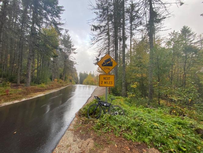
![Cycling Hurricane Mountain Road West, New Hampshire Cycling Hurricane Mountain Road West, New Hampshire - cyclist climbs on wet, one-lane roadway surrounded by green trees and forestation]()
Cycling Hurricane Mountain Road West, New Hampshire
Ride 1.8 miles gaining 983’ at 10.2% average grade.
This is the shorter side and “easier route” (ha, ha) to the top of Hurricane Mountain Road. The approach from the east is New Hampshire’s second hardest bike climb (after Mt. Washington), but the western ascent is no slouch, coming in at New Hampshire’s #4 toughest bike climb.
![Cycling Hurricane Mountain Road West, New Hampshire Cycling Hurricane Mountain Road West, New Hampshire - photo collage, Garmin device reading 22% grade, bike parked in forestation on side of road, dense fall foliage, PJAMM Cycling logo in corner]()
The steepest quarter mile is 15.6% and steepest half mile is 14.2%.
“The west side of Hurricane Mountain Road near North Conway is a famous area climb, even steeper than its east side but just a bit shorter and also along a dark and narrow route. Although it has somewhat similar statistics this side seems to have a more ominous look and feel as you ride it. A variable grade will wear you down and the maximum is near the top just before a steep right hand turn. From this point the listed top is close and it is unmarked but obvious as the grade decreases dramatically. Due to its steep grade and narrow guage it is also a difficult descent.” (This quote is provided with the approval of John Summerson from his book, The Complete Guide to Climbing (by Bike) in the Northeast, pg. 95.)
![Cycling Hurricane Mountain Road West, New Hampshire Cycling Hurricane Mountain Road West, New Hampshire - road sign reads " Road Not Suitable For Large Vehicles or RV's"]()
Start -- the road pitches up immediately to double digits.
Roadway surface is excellent and there is minimal traffic on this climb.
![Cycling Hurricane Mountain Road West, New Hampshire Cycling Hurricane Mountain Road West, New Hampshire - photo collage, cyclist climbing on wet, one-lane roadway in pristine condition, surrounded by dense fall foliage, PJAMM Cycling logo in corner]()
This is an extraordinary climb during the fall.
![Cycling Hurricane Mountain Road West, New Hampshire Cycling Hurricane Mountain Road West, New Hampshire - cyclist climbing on wet, one-lane roadway covered in bright yellow and red fall foliage, bike parked against large tree on roadside]()
![Cycling Hurricane Mountain Road West, New Hampshire Cycling Hurricane Mountain Road West, New Hampshire - bike parked against road signs for Conway and Bartlett, one-lane roadway surrounded by dense forestation, PJAMM Cycling logo in corner]()
Conway and Bartlett are nearby towns.
![Cycling Hurricane Mountain Road West, New Hampshire Cycling Hurricane Mountain Road West, New Hampshire - two cyclists stand on one-lane roadway at climb's finish, surrounded by dense forestation, sunlight peeking through trees]()
Finish of the eastern and western approaches.
Hurricane Mountain is located in New Hampshire’s amazing White Mountains. Visit our White Mountains Fall Colors Climb Page for more information on this area.
![]()
That’s a wrap!

 We've partnered with Sherpa-Map.com to bring you the best route planning tool. With a PRO Membership you can use this climb as a reference when creating your route.

